Where Your Water Comes From
Since our region has limited water below ground (that could be pumped out through wells), lakes provide the most reliable water.
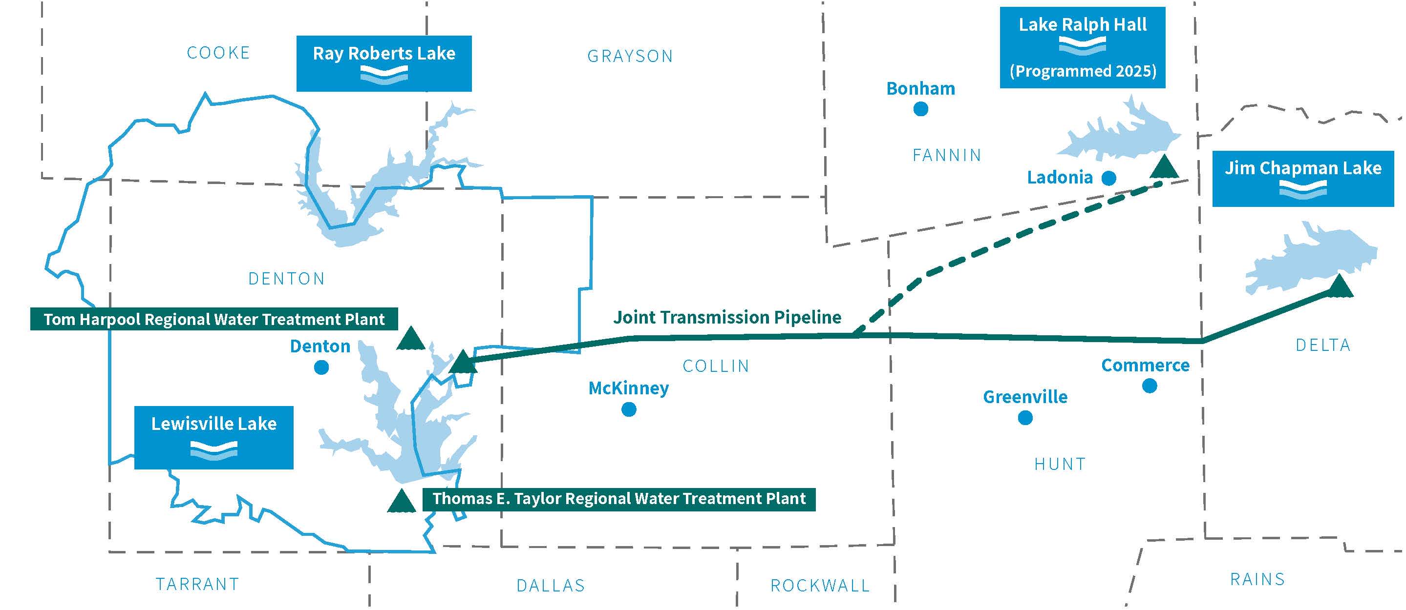
To make sure that we can provide a dependable, secure and adequate supply, Upper Trinity Regional Water District (UTRWD) draws from various surface water sources.
Our water sources include:
- Lewisville Lake (by contract with cities of Dallas and Denton)
- Ray Roberts Lake (by contract with cites of Dallas and Denton)
- Jim Chapman (Cooper) Lake in northeast Texas (by contract with City of Commerce)

Water from Lewisville and Ray Roberts Lakes is treated directly at our Tom Taylor Water Treatment Plant in Lewisville, TX. Our water from Chapman Lake comes through a pipeline jointly owned by the City of Irving and UTRWD, and operated by the city. A portion of UTRWD’s water from Chapman Lake is delivered to our new Tom Harpool Water Treatment Plant in northeast Denton County. The other portion is delivered to Lewisville Lake for treatment at the Tom Taylor Water Treatment Plant.
To learn how UTRWD treats water from these water supply lakes, check out the interactive graphic by clicking the link below.
Need for Future Water
North Texas is one of the fastest growing regions in the country. Our water currently serves North Texans across Denton, Dallas and Collin Counties, a number that is anticipated to grow nearly 500 percent in the next 50 years. Our current water supplies should provide us with adequate water for the next 25 years. After that time, we will need additional conservation and reuse as well as new water sources to meet our needs.
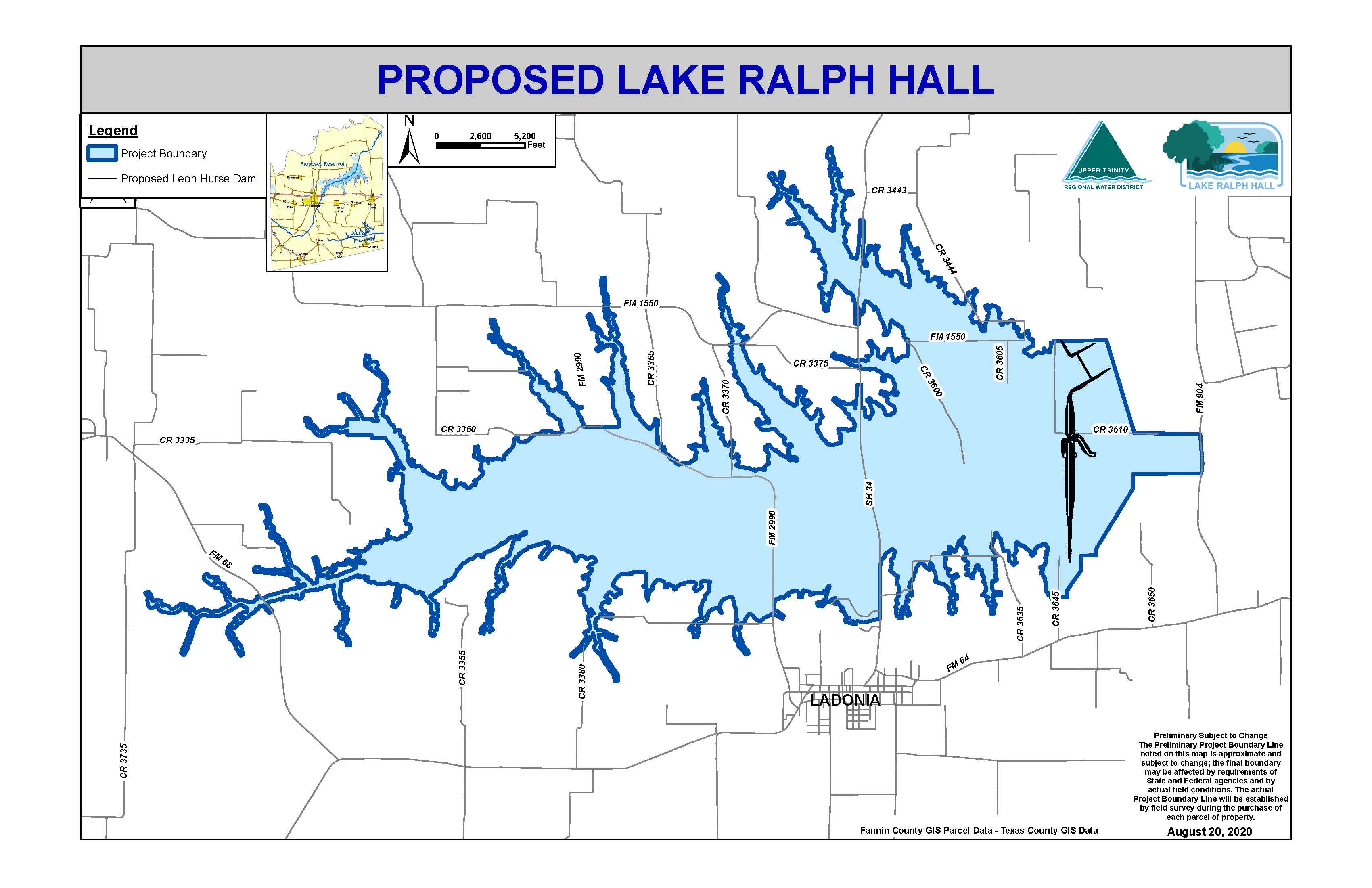
To provide for our Members and Customers, UTRWD is building Lake Ralph Hall along the North Sulphur River in Fannin County. Named after Texas congressman Ralph Hall from Rockwall, it will deliver an additional 35 million gallons daily (mg/d) of raw water and 19 mg/d of reused water every day. For more information visit .

However, additional sources of water will be needed to meet the future needs of our growing region. We will continue to seek out, plan and add additional sources of water to account for this growth and increasing demand.
